Forests Act · Prohibited Area · Both
All Forest Reserves
Forest Reserve Estate · Forests Act · Trinidad & Tobago
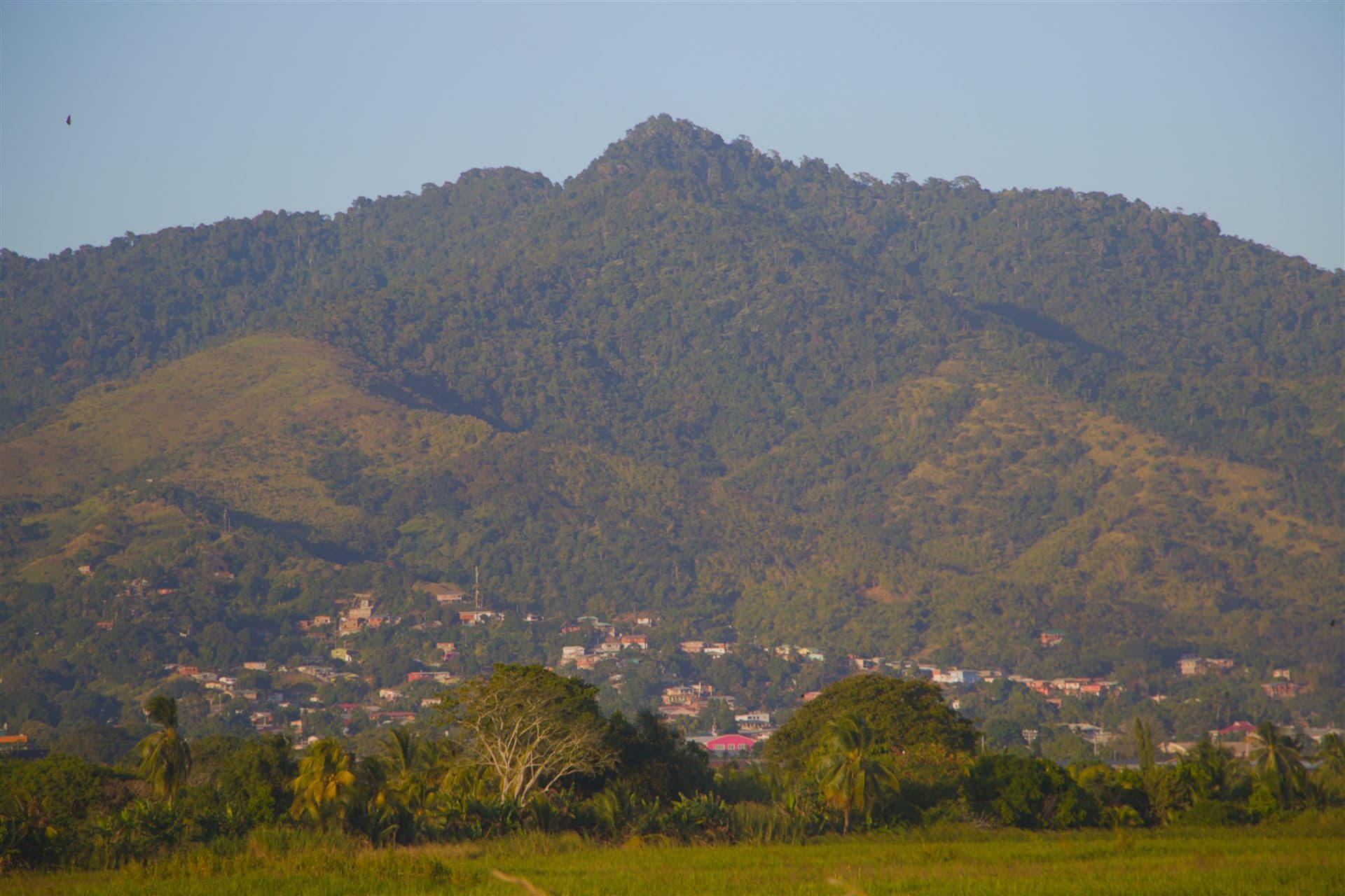
Photo: 999real · Northern Range, Trinidad (CC0)
The entire Forest Reserve estate of Trinidad and Tobago is protected under the Forests Act, Chap. 66:01. Clearing, settlement, unlicensed timber extraction, cultivation, and burning within any gazetted Forest Reserve are prohibited offences. The State holds these lands in trust as watershed protection, biodiversity reserves, and a foundation for sustainable forest management.
The Forests Act, Chap. 66:01, empowers the President to gazette any State land as a Forest Reserve, vesting control in the Conservator of Forests (the Chief Forest Officer). Within any Forest Reserve, it is an offence to clear vegetation, cultivate land, settle, burn, fell trees, or remove timber and forest produce without a licence or permit issued by the Conservator. The Act also creates a parallel category - Prohibited Areas - where entry itself is restricted by Order and is an offence without written authorisation from the Forestry Division. Penalties for violations were strengthened by the Forests (Amendment) Act, No. 23 of 1999, which raised the maximum fine to TT$50,000 and the maximum custodial sentence to two years for offences such as unlicensed felling, removal of forest produce, and unauthorised entry into a Prohibited Area.
Trinidad holds approximately 35 proclaimed Forest Reserves with a combined area of around 131,430 hectares, representing roughly 54 percent of the State-owned forested estate. A further 8 State forest blocks are managed by the Forestry Division without formal proclamation. Tobago adds the Main Ridge Forest Reserve. All known named reserves are listed below.
Day-to-day management and enforcement are carried out by the Forestry Division of the Ministry of Agriculture, Land and Fisheries through its network of Forest Rangers. Rangers patrol boundaries, investigate encroachment and illegal logging, respond to bushfires, and issue removal permits for approved activities such as scientific research and eco-tourism. Several Forest Reserves overlap with, or directly border, gazetted Game Sanctuaries under the Conservation of Wildlife Act - notably the Trinity Hills Wildlife Sanctuary within the Victoria-Mayaro reserve landscape and the Caroni Swamp - creating a dual legal protection framework for the most sensitive zones.
Principal Reserves
Arena Forest Reserve
Approx. 3,797 acres (1,537 ha) of tropical evergreen forest in central Trinidad; contains important Blue-and-gold Macaw nesting habitat.
- Forests Act, Chap. 66:01 (Forest Reserve)
Arima Forest Reserve
Northern Range foothills, near Arima; upper catchment forest protecting the Arima River watershed.
- Forests Act, Chap. 66:01 (Forest Reserve)
Blanchisseuse Forest Reserve
Northern Range, north coast; steep forested slopes above the Blanchisseuse coastal corridor.
- Forests Act, Chap. 66:01 (Forest Reserve)
Brigand Hill Forest Reserve
Eastern Trinidad; forested hill rising above the Nariva plain, near Mayaro.
- Forests Act, Chap. 66:01 (Forest Reserve)
Cap de Ville Forest Reserve
Southern tip of Trinidad, Cedros peninsula; coastal and seasonal forest.
- Forests Act, Chap. 66:01 (Forest Reserve)
Caroni Swamp Forest Reserve
West Trinidad; tidal mangrove estate overlapping the Caroni Swamp Game Sanctuary and Ramsar Site No. 1497.
- Forests Act, Chap. 66:01 (Forest Reserve)
- COWA First Schedule Item 9 (Game Sanctuary)
- Forests (Prohibited Areas) Order GNs 156/1954, 145/1958, 136/1959, 122/1960, 129/1966, 141/1987
- Ramsar Site No. 1497 (listed 8 July 2005)
Cedros Forest Reserve
South-western peninsula, Cedros area; dry seasonal forest near the Serpent's Mouth strait.
- Forests Act, Chap. 66:01 (Forest Reserve)
Central Range Forest Reserve
Central spine of Trinidad; seasonal and semi-evergreen forest overlapping the Central Range Game Sanctuary and prohibited area.
- Forests Act, Chap. 66:01 (Forest Reserve)
- COWA First Schedule Item 3 (Game Sanctuary)
- Forests (Prohibited Areas) Order Subsection (14), GN 62/1999 (Prohibited Area)
Eastern Extension Matura Forest Reserve
North-east Trinidad; forested extension of the Matura block, adjacent to Matura National Park.
- Forests Act, Chap. 66:01 (Forest Reserve)
- Adjacent to Matura National Park ESA, EMA Act, Chap. 35:05; GN 323/2004
Ecclesville Windbelt Forest Reserve
Mayaro-Rio Claro area, south-east Trinidad; plantation windbelt protecting agricultural land.
- Forests Act, Chap. 66:01 (Forest Reserve, plantation windbelt)
Erin Forest Reserve
South Trinidad, Erin Bay area; coastal forest and mangrove fringe.
- Forests Act, Chap. 66:01 (Forest Reserve)
Freeport Mission Forest Reserve
Central Trinidad, Freeport area; seasonally flooded forest on the Caroni River plain.
- Forests Act, Chap. 66:01 (Forest Reserve)
Godineau Swamp Forest Reserve
South-west Trinidad; mangrove and swamp forest at the Godineau River estuary, Gulf of Paria.
- Forests Act, Chap. 66:01 (Forest Reserve)
Las Cuevas Forest Reserve
North coast, Northern Range; steep forested slopes above Las Cuevas Bay.
- Forests Act, Chap. 66:01 (Forest Reserve)
Long Stretch Forest Reserve
North-central Trinidad; declared a prohibited area in 1987; overlaps with the Aripo Savannas ESA, including habitat for two plant species found nowhere else on Earth.
- Forests Act, Chap. 66:01 (Forest Reserve; proclaimed January 1934 under Forest Ordinance Chap. 141)
- Forests (Prohibited Areas) Order Subsection (8), GN 113/1987 (Prohibited Area, effective 15 June 1987)
- EMA Act, Chap. 35:05, Aripo Savannas ESA (June 2007)
Longdenville Forest Reserve
Central Trinidad, Longdenville area; seasonally flooded lowland forest in the Caroni plains.
- Forests Act, Chap. 66:01 (Forest Reserve)
Mac Nair Ravine Forest Reserve
North-central Trinidad; ravine and gallery forest providing slope stabilisation.
- Forests Act, Chap. 66:01 (Forest Reserve)
Manzanilla Extension Forest Reserve
East coast, Trinidad; forested buffer adjacent to the Manzanilla-Nariva coastal strip.
- Forests Act, Chap. 66:01 (Forest Reserve)
Manzanilla Windbelt Forest Reserve
East coast; planted windbelt along the Manzanilla seafront, sheltering the coastal road and adjacent farmland.
- Forests Act, Chap. 66:01 (Forest Reserve, plantation windbelt)
Matura Reserve Western Extension Forest Reserve
North-east Trinidad; western buffer extension of the Matura forest block.
- Forests Act, Chap. 66:01 (Forest Reserve)
- Buffer to Matura National Park ESA, EMA Act, Chap. 35:05; GN 323/2004
Matura Swamp Forest Reserve
North-east Trinidad; freshwater swamp and transitional forest near Matura Beach, within Matura National Park ESA.
- Forests Act, Chap. 66:01 (Forest Reserve)
- Within Matura National Park ESA, EMA Act, Chap. 35:05; GN 323/2004
Melajo Forest Reserve
North-east Trinidad; upland forest in the Aripo-Melajo area, north of the Aripo Savannas.
- Forests Act, Chap. 66:01 (Forest Reserve)
Morne L'Enfer Forest Reserve
South-west Trinidad, Fyzabad-La Brea area; approx. 3,868 ha; also a Game Sanctuary and prohibited area. Site of an NGC-funded reforestation programme.
- Forests Act, Chap. 66:01 (Forest Reserve)
- COWA First Schedule Item 11 (Game Sanctuary)
- Forests (Prohibited Areas) Order Subsection (14), GN 62/1999 (Prohibited Area)
Nariva Windbelt Forest Reserve
East Trinidad; 6,267 acres (2,536 ha) plantation windbelt declared 18 March 1954; flanks the Nariva Swamp Ramsar Site.
- Forests Act, Chap. 66:01 (Forest Reserve; declared 18 March 1954)
Northern Range Forest Reserve A (NRRA)
Western section of the Northern Range spine, from Chaguaramas peninsula eastward; part of the largest continuous forested block in Trinidad.
- Forests Act, Chap. 66:01 (Forest Reserve; Proclamation No. 8 of 1922)
- Forests (Prohibited Areas) Order Subsection (10), GN 155/1989 (Prohibited Area, effective 27 September 1989)
- Overlaps Northern Range Game Sanctuary, COWA First Schedule Item 1
Northern Range Forest Reserve B (NRRB)
Central section of the Northern Range, spanning the Maracas-Arima watershed corridor.
- Forests Act, Chap. 66:01 (Forest Reserve; Proclamation No. 8 of 1922)
- Forests (Prohibited Areas) Order Subsection (10), GN 155/1989 (Prohibited Area, effective 27 September 1989)
Northern Range Forest Reserve C (NRRC)
Eastern section of the Northern Range from Arima to Toco; together NRRA, NRRB, and NRRC form the island's largest forested landscape.
- Forests Act, Chap. 66:01 (Forest Reserve; Proclamation No. 8 of 1922)
- Forests (Prohibited Areas) Order Subsection (10), GN 155/1989 (Prohibited Area, effective 27 September 1989)
Paria Forest Reserve
Northern Range, Paria peninsula; remote coastal rainforest accessible only by trail, one of the least disturbed forests in Trinidad.
- Forests Act, Chap. 66:01 (Forest Reserve)
Rochard Douglas Forest Reserve
Central-eastern Trinidad; upland seasonal forest.
- Forests Act, Chap. 66:01 (Forest Reserve)
San Pedro Forest Reserve
North-central Trinidad; forest block on the southern slopes of the Northern Range.
- Forests Act, Chap. 66:01 (Forest Reserve)
Siparia Forest Reserve
South-west Trinidad, Siparia area; seasonal forest on the fringes of the Southern Range hills.
- Forests Act, Chap. 66:01 (Forest Reserve)
Southern Watershed Forest Reserve
South Trinidad; also a Game Sanctuary under COWA and a prohibited area under the Forests Act; protects freshwater catchments for south Trinidad communities.
- Forests Act, Chap. 66:01 (Forest Reserve)
- COWA First Schedule Item 5 (Game Sanctuary)
- Forests (Prohibited Areas) Order Subsection (14), GN 62/1999 (Prohibited Area)
St David Forest Reserve
North-east Trinidad, St David County; forested state lands in the Toco-Sangre Grande corridor.
- Forests Act, Chap. 66:01 (Forest Reserve)
Tacarigua Forest Reserve
North-west Trinidad; forest block near the Tacarigua area, east of Port of Spain.
- Forests Act, Chap. 66:01 (Forest Reserve)
Todd's Road North Forest Reserve
Central Trinidad; seasonal forest on State lands along the Todd's Road corridor.
- Forests Act, Chap. 66:01 (Forest Reserve)
Todd's Road South Forest Reserve
Central Trinidad; seasonal forest south of the Todd's Road area.
- Forests Act, Chap. 66:01 (Forest Reserve)
Tumpuna Forest Reserve
North-east Trinidad, Arima-Tumpuna area; upland forest protecting the upper Tumpuna River catchment.
- Forests Act, Chap. 66:01 (Forest Reserve)
Victoria-Mayaro Forest Reserve
Over 50,000 ha of lowland and seasonal forest in south-east Trinidad; the largest single Forest Reserve in Trinidad, adjacent to the Trinity Hills Wildlife Sanctuary.
- Forests Act, Chap. 66:01 (Forest Reserve; over 50,000 ha)
- Trinity Hills Game Sanctuary, COWA First Schedule Item 4
- Forests (Prohibited Areas) Order Subsection (10), GN 155/1989
Yarra Forest Reserve
Central-eastern Trinidad; seasonal forest in the Yarra River watershed.
- Forests Act, Chap. 66:01 (Forest Reserve)
Main Ridge Forest Reserve (Tobago)
Approx. 3,958 hectares of lower-montane and lowland rainforest along the central ridge of Tobago. Gazetted 13 April 1776 - the oldest legally protected forest in the Western Hemisphere.
- Forests Act, Chap. 66:01 (Forest Reserve)
- Gazetted 13 April 1776, National Forest Policy 2011, §1.2.3.1
Why This Matters
Trinidad and Tobago's Forest Reserve estate represents the largest single category of protected land in the country. The approximately 35 proclaimed Forest Reserves in Trinidad, together with the Main Ridge Forest Reserve in Tobago, protect roughly 131,430 hectares of the state-owned forested estate: an interconnected system of watersheds, carbon stores, and biodiversity refuges that underpins the ecological functioning of both islands. These are not museum pieces; they are working natural systems that produce the clean water, regulated flooding, and habitat connectivity that communities across T&T depend on every day.
The watershed services alone justify the protection. Every major river system in Trinidad, from the Caroni to the Ortoire to the Oropouche, has its headwaters in Forest Reserve land. The forests intercept rainfall, slow runoff, prevent erosion, maintain water quality, and regulate the seasonal flow that determines whether communities downstream experience floods or drought. In an era of increasingly variable rainfall, intact forest catchments are not a conservation luxury; they are critical infrastructure. The penalty regime under the Forests Act, strengthened by the 1999 amendment, exists because the value of what is being protected demands serious deterrence.
The Forest Reserve estate is also the matrix within which every other form of protected land in T&T is embedded. Game Sanctuaries, ESAs, and Prohibited Areas all function more effectively when they are surrounded by and connected to intact Forest Reserve land. The reserve system is, in this sense, the foundation on which the entire protected area network rests. Its management requires consistent resourcing of the Forestry Division's ranger corps, active boundary enforcement, and a political commitment to treating Forest Reserve land as the national asset it is.
Legal Protections
This area is declared a prohibited area under the Forests Act, Chap. 66:01, or under an Order made pursuant to that Act. Entry, clearing, hunting, and resource extraction within its boundaries without State authorisation is a criminal offence. Penalties include fines and imprisonment. If you witness illegal activity within this area, report it immediately.
Report a ViolationCurrent Threats
- Illegal clearing and logging
- Squatting and encroachment
- Bushfire and deliberate arson
- Quarrying at forest boundaries
- Agricultural conversion of forest edges
- Inadequate ranger coverage relative to reserve area
Primary Sources & Legal Citations
- Forests Act, Chap. 66:01
- Forests (Amendment) Act, No. 23 of 1999
- National Forest Policy 2011 · Sections 1.2.3.1–1.2.3.3 (aggregate figures and reserve management)